Fossil Springs
Trailhead GPS: N 34 24.402' W 111 34.106'
GPS Location of Destination: N 34 25.457' W 111 34.400'
Trailhead Elevation: 5600 ft.
Elevation at Springs: 4320 ft.
Elevation Change: 1280 ft.
Nearest Town: Strawberry, AZ
Length: 7 miles round trip
Difficulty (10=hard, 1=easy): 6
Wilderness Area: ?
Vehicle: Anything
Directions to Fossil Springs
Take Highway 87 towards Payson. You'll pass Payson, Pine, and then you'll come to Strawberry. At Strawberry take a left on Fossil Creek Road. Stay on it for about 5 miles. The first 2 miles or so is paved, the next 3 miles will be on a well-maintained dirt road that any car can drive on. After about 5 miles on Fossil Creek Road you'll see a turnoff that leads to a parking lot on the right side. That's where you begin.
It's recommended that you contact the national forest before visiting Fossil Springs to make sure that it's open:
Coconino Natl' Forest Supervisor's Office: (928) 527-3600, Mon-Fri, 8 a.m. - 4 p.m.
Mogollon Rim Ranger District, 8738 Ranger Road, Happy Jack AZ 86024, (928) 477-2255
Our First Trip to Fossil Springs
By Cyndi Taylor
We began our journey to Fossil Springs based on rumors from a friend that it was a "must see" - after we made it to the spring and the beautiful oasis - we view that as an understatement. Coming from Mesa in the beginning June, we were grateful to head to higher elevation and seemingly much cooler air. We started around eight and with a two hour drive arrived to the parking lot around 10am.
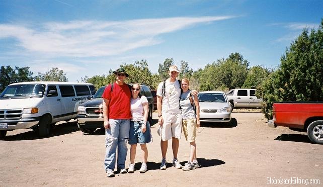
From the parking lot you can see the pine trees that grace this land and the mountains in which Fossil Springs is tucked away. You follow the signs out of the parking lot, that are labeled "Fossil Springs", onto a very well maintained trail. The trail is the remains of the old road used to ship materials to the dam. It is pretty clearly marked which way you should go and the majority of the time there are fellow hikers nearby to point you in the right direction.

The trail is fairly down-hill right from the start. While you are descending you get a clear view of the Mogollon Rim. The trail is also filled with beutiful vistas of the pine forests that surround this area and the desert mesas that jut upwards out of the valley. The hiking is fairly easy going since it is mainly downhill and the trail is well-traveled. As you are descending you will see from a distance a strip of brillant green vegetation. This is where Fossil Springs is flowing.
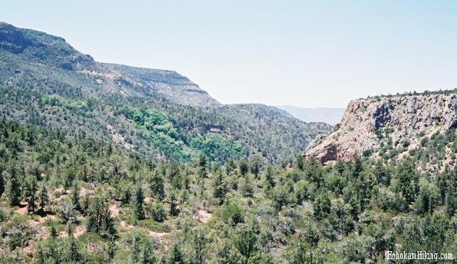
When you are nearing Fossil Springs you will come across a rocky river bed that you must cross. It was fairly dry during our trip but the boulders are probably large enough you can walk across without too much difficult even if there is water. If you are worried about it, avoid hiking during the wet season or soon after rain.
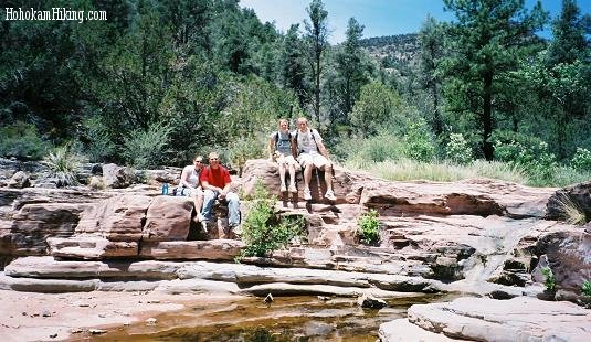
Soon after this you will start to recognize the change in vegetation from pine to leafy trees. You will come across the first spot where a spring pours from the ground. This is an excellent place to refill your water bottles. We used a filter but that might not even be necessary.
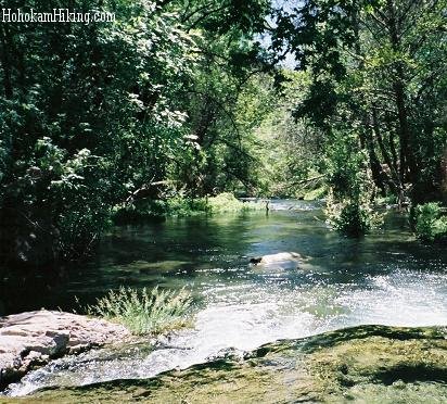 |
The first pool you encounter at Fossil Springs is great for wading and there is a small rope swing. There are two ways to go from here, you can head strait and come to another pool with a rope swing and a small trail that leads to the dam or you can head to your right up a trail where you will pass through camping areas and come to the Old Flum Road. From here, head down one of the many trails to the water. This is the place where you will find the neatest attractions of all at Fossil Springs. |
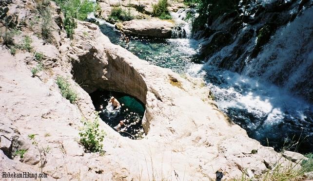
This picture was taken from the top of the Fossil Springs dam. Here you can see a large hole that is filled with water deep enough to jump from the ledge into the hole and an underwater arch that allows you to swim out. The boys thoroughly enjoyed the cliff diving and swimming here. Be careful and proceed at your own risk.
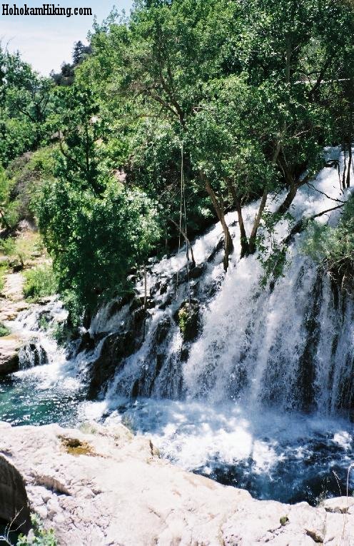
To the right of the Fossil Springs dam is a large waterfall that envies anything I have seen in Hawaii. It has been featured in Arizona Highways and lends itself to some beautiful photography.

This is the boys after they have swimmed out of the hole and are heading towards the waterfall. The current at the base of the waterfall is fairly weak. As far as we could tell, it would not suck you back into it. It is a great area to swim around and climb on the nearby rock formations

The boys could not stand just looking at the waterfall and decided they needed to hike up it--they said it's easier than it looks. There is a rope swing and from their point of view it was fairly safe to swing out from. Once again proceed with caution and at your own risk. The water is amazingly clear and the majority of the time you can see to the bottom. Because Fossil Springs is flowiwng so quickly very little algae and moss grow in the water. Strapped on sandals, old tennis shoes, or bare feet would probably all work great.
 |
Further down Fossil Springs, you will find a canyon that is really pushing the water through. It is fun to swim against the current and see how far you can get. Be cautious because this water is flowing fast and you can easily bang your knees on underwater boulders if not careful. On the right there is also a cave that you can swim into. We played down here for quite awhile, swimming and jumping from a few of the rocks into the water. |
The water was pristine, the weather beautiful, and the surrounding area lush. If you need a break from the desert heat, Fossil Springs would probably be my number one recommendation. Just make sure with all the fun you have that you save enough energy for the hike out because it is uphill 90% of the way. If you have the time make it an overnighter... although we did it in one day and definently have no regrets!
Additional Information from USDA Forest Service
RANGER DISTRICT
Payson Ranger Station
1009 East Highway 260
Payson, Arizona 85541
Phone (928) 474-7900
Fax (928) 474-7999
TRAILHEADS (TH)
Fossil Springs TH
TERMINI INFORMATION
South end: (5600 feet elevation): at Fossil Springs
Trailhead
North end: (4320 feet elevation): at Fossil
Springs
TRAIL INFORMATION
Trail use: Heavy
Trail difficulty: More difficult
Trail length: 3.1 miles
Estimated hiking time: 2 hours one-way
Season of Use: Spring - fall
USGS maps: Strawberry
Elevation change: 1280 feet
TRAIL NARRATIVE
The Fossil Springs Trail 18 was once a rough
wagon road. It is now a steep trail and has little
shade.
ATTRACTIONS
•Spectacular early morning and late afternoon
views of the Mogollon Rim
•Fossil Springs is a riparian area with plenty of
shade.
•There are limestone caves along the trail
•Trail’s end is near a swimming hole
•This trail has been featured in Arizona Highways
magazine.
CONSIDERATIONS
•No motorized vehicles are allowed
•Please observe Wilderness regulations; the
springs lie within the Fossil Springs Wilderness
Area.
•Caution should be taken when using this trail in
the summer heat.
•Carry an adequate supply of drinking water. One
gallon/per person/per day is recommended during
hot periods.
•Do not drink untreated water. Giardia, protozoan,
is in many water impoundments and streams.
•Portions of the trail are rough in places and
should be traveled with caution.
•If you PACK IT IN, PACK IT OUT!!
